Saturday, September 24, 2005

Kayak Stories Finished

Here is the last of the kayak spam
I have finished the blog and thats the end of this
story
Hope you-all have enjoyed the stories
till the next adventure
TTFN
The web-toed-ChrisPCritter

http://kayakinsidepassage.blogspot.com/


__________________________________
Yahoo! Mail - PC Magazine Editors' Choice 2005
http://mail.yahoo.com

Wednesday, September 21, 2005

August 16, 2005


wPict16th
Originally uploaded by Au_Kalan.
Kayaking Northwest

Mary Lou took the 8:30 am ferry to Bella Bella where the airport was. I was strange to be sitting on the dock by myself and watching her go away. I have just had four days with her and I don’t think I could not of finished the trip without her.

As I kayaked along the shore an old motorboat pulled out from a house on the water. The elderly lady gave me a wave and took off. The boat suddenly turned to the right and started to do a high speed U-turn right back at the house and shore. The lady Ripple, quickly stopped her motor and I paddled over to her. It turns out that Ripple’s steering cable had broken and she was stranded. She was calling for help on her radio but she was afraid that she would be on the rocks before help could arrive. I offered to tow her back to her dock, she looked quite skeptical at me in the kayak as she tossed me the rope. I was able to tow her back to her dock but she was mortified that the neighbor had come out to see her being towed by a tourist in a kayak. We all had a good laugh and I headed on my way.

August 17,2005


wPict17th
Originally uploaded by Au_Kalan.
Fog – The morning was a training course in kayaking from small island to island in the fog. I had to take compass bearing and paddle without any land in site. I did pretty well, I just had to back track twice.

Another nice camp on Pidwell Beach in Milbanke Sound, on the south side of Swindle Island. For company I have 47 Gulls on the shoreline and a Raven that seems to have no fear of me. As I watch him walk across the sand just 10 feet in front of me crooning a song to me I just happen to look over my shoulder to see Raven 2 with its head in my food bag. Well, I figured that if they were that smart that they could have whatever they got of my camp food.

August 18, 2005


wPict18a
Originally uploaded by Au_Kalan.
Klemtu

I kayak into Klemtu, a small native village. It is amazing the difference between Bella Bella and Klemtu. As I walked down the dock everyone smiled and said hello, I ended up talking to a local fisherman for 40 minutes. As I walked around town taking pictures of Totems everyone waved or greeted me. Ended up meeting Roy who teaches woodworking at the school and does some carving as well. Roy and I talked carving for over and hour and went to see his Totem at the Gas Dock.


I met Frankie the Fisherman on the dock, he was from further up the coast, a village called Port Simpson. There were about 20 commercial fishing boats tied up to the dock. It turns out that the fishing season had been closed for the last week and the Government was to broadcast at 2 pm if it was to open again. It turns out most of the fishermen were from port Simpson and if the fishing season was going to stay closed that they were going to go home. I was up on the hill near the Big House, kind of a native community hall when I saw many of the fishing boats heading North up the Fraser Reach. It was just past 2 pm and I guess the Government had bad news. It must be hard to make a life fishing, never knowing if there will be enough fish to even open the season and pay for even the fuel of the trip.

From Klemtu I go North and camp on Sarah Island.

August 19, 2005


wPict19
Originally uploaded by Au_Kalan.
RAIN
RAIN
RAIN
RAIN from the Southeast

I was reading Kwakiutl Ethnography by Franz Boas and there was an interesting part on the weather
“When you make war on the Southeast Wind and Rain because it never becomes calm, as soon as you start…..The Northwest wind shall come and blow against the Southeast Wind and it will blow one day; then it will be calm for four days.”
So my hope was that once the NW wind started to blow again that I would have 4 good days of paddling.

August 20-22, 2005


wPict20
Originally uploaded by Au_Kalan.
I kayak west through Meyers Passage with the tide, it makes a fun ride with currents up to 3 knots. I end up spending three nights on Milne Island and just exploring the area. I was walking along the shore at low tide and headed out to a small island connected to Milne by the low water. Such a small island could not hold any bears I thought. I stepped onto the grass of the island about 20’ from the bushes when I heard a large crashing sound of brush being crushed. I had woken a sleeping bear that was quite surprised to see me. Well, I let him have his Island and I headed back to mine. The next day I spend exploring by kayak, I figure it was safer.

August 23, 2005


wPict23
Originally uploaded by Au_Kalan.
Wake up at 6:30 am, for an early start up the coast, I have done 378 paddle miles so far during the trip from Lund. I hear a strange noise, the tent is rustling in the wind. The morning are usually calm and the wind does not pick up till 10 am. As I paddle out the wind is from the NW and gusting strong. The wind has been from the SE the last few days, I wonder if this is what Boas was talking about. Maybe I will get 4 days of calm weather after this. I only make it 10 miles that day because the wind is so strong.
At camp that night I hear a deep eerie hollow resonance sound like a church organ pipe. The forest spirits were playing with my over active imagination. I decided to find out what was making the sound. What I found was a 150’ tall old snag that hollows in it. The wind was blowing past the hollows in the trees and forming a giant wind instrument. I am now trying to figure out how I can build one and install it on top of a tree.

August 24, 2005


wPict24
Originally uploaded by Au_Kalan.
Another early start to make up for yesterday’s short day due to the wind. I kayaked up Laredo Channel between Aristazaball Island and Princess Royal Island. This is an exposed part of the coast that has a rock wall coastline and is open water to Hecate Straight. The rocky coastline has very few coves or inlet and no beaches for camping. I needed a day of calm winds to do this stretch and I got it, those Kwakiutl knew what they were talking about.
As I kayaked along the cliffs I saw two foot long orange/red tentacles climbing the seaweed covered rock wall. It was an octopus that was after something tasty. Once it noticed me it slithered back into the sea. Gave me the creeps, made me think of Captain Nemo and Nautilus and the giant squid. It made me want to turn around and see if anything was slithering up the back of my kayak.

August 25, 2005


The fog had blown out of the inlet and now covered my island. As I paddled out I was treated to an incredible but subtle display of morning light and fog as I went between miniature islands. The light was sliding between the low clouds and the mountains of Princess Royal Island and playing with the flowing fog.


wPict25b
Originally uploaded by Au_Kalan.

From there I traveled North up Campania Sound and into Barnard Harbor for my next camp. I expected the harbor to be another secluded and empty camp. How wrong I was, as I entered the harbor a float plane flew 40 feet over my heat and a sport fishing boat went roaring by. As I paddled into the bay I was greeted by the site of a giant floating deluxe hotel / fishing resort. It had 3 float planes at the dock, 20 fishing sport boats, a floating septic tank and a helicopter for the guest to go site seeing. I bet the guests don’t even touch the fish they catch. It was quite the shock after being alone for so many days. Safe to say that I kept my distance from the monster.

August 26, 2005


wPict26a
Originally uploaded by Au_Kalan.
33 Paddle Miles to the Hotsprings

From Barnard Harbor I traveled up Whale Cannel in a constant down pour of rain that would occasionally give into a light drizzle. The good part was that there was no wind at all till noon. Whale Channel is aptly named, I saw several Humpback Whales and one even breached. It is an amazing site to see something the size of a school bus levitate itself out of the water. They must be traveling at an incredible speed, I wonder how they keep from running into or landing on boats. As I rounded Nelly Point and started into MaKay Reach I saw a pod of Porpoise playing in the eddy currents and an Ospray flew overhead with a fish in its talons.


I was determined to make it to the Hot Springs on that day even though it was going to be a long day, 33 miles. The Weather Gods had some fun with me as I passed the North end of Fraser Reach. I had to battle 3 foot standing waves and gusting winds as they came out of the Reach. By the time I reached the Hot Springs it was 7 pm and I was whooped, I had just paddled 11 hours. There was three sport fishermen there, Ivar, Floyd and Collin who were from Saskatchewan. It is a small world, they even new people in the town of Blane Lake where my Grandparents lived. Well, that almost made me family so they invited me to join them for dinner. Ahhhh, it was great to eat someone else’s cooking. A hot dinner and a soak in the Hot Springs made the long day of paddling worthwhile. My hands were worse for wear, they now looked like prunes from all the rain.

August 27, 2005


wPict27a
Originally uploaded by Au_Kalan.
Spend the day at the Spa.

The winds had picked up, or so I had convinced myself, so I spent another day at the Hot Springs. I tried to dry out some clothing but it was 110% humidity and it just seemed to get wetter as it hung on the line.


Bishop Bay Hot Springs are great. It has a dock to land at, wooden boardwalks that lead to campsites, a shelter, and the springs. There are 3 tubs at the springs, the hottest in covered and the next one is out on a wood deck overlooking the bay. The third is a little one that is for bathing in, it felt so good to scrub myself clean. They are very secluded, you can only reach them by boat and the closest town is over 60 miles away. It is an amazing sanctuary in the wilderness. To top it all off, Humpback whales were feeding in the bay for hours every evening and morning.

August 28, 2005


wPict28
Originally uploaded by Au_Kalan.
August 28, 2005

POOOOOFFFF As I kayak out of Bishop Bay the Humpback whales give me quite a show close to the kayak. I end up camping on the south end of Promise Island, this sets me up to go to Hartly Bay on Monday, the next day. In Hartly I get my final food shipment and I get to call Mary Lou and tell her I’m safe.

August 29, 2005


wPict29a
Originally uploaded by Au_Kalan.
Kayak into Hartley Bay, it is an amazingly clean village. All the roads and walkways are raised wood boardwalks. Not a drop of gravel or pavement anywhere. Everyone walks or drives ATV’s to get around town. A friendly dock worker directs me to the Post Office where I get my last box of supplies and a letter from Aunt Vernie. There is no public pay phone in town or within 50 miles. The kind people at the development center let me use their phone to call home. It’s been 11 days since I talked to Mary Lou, we yak for a good long time.


ML told me that the Hank and Carolyn had been in touch with her and were looking for me. On the 27th they were at the south end of Pitt Island, this was when I was at the Hot Springs so it looked like I missed them. If they were still in the area ML said that they were going to try and track me down.

Back at the tent I spend the afternoon sorting and organizing all of my new food. I still had rice, organic pesto pasta, cuscus, cashews, almonds, more mixed nuts, granola, It looks like I had more food than I knew what to do with. With the fishing that I had done my supplies were lasting longer than planned.

August 30 - 31, 2005


wPict30
Originally uploaded by Au_Kalan.
I traveled up Greenville Passage a few miles and then took a left into Union Passage, a narrow estuary that would bring me to Squally Channel and the south end of Pitt Island. As I paddled down to the south tip of Pitt I saw no signs of Hank and Carolyn’s boat, I
guess that they were to far away to make it back. I found a little beach where I could make camp and had a late lunch. 45 minutes later I see a small red boat, it’s them, I wave my yellow jacket like crazy till they see me and then paddle out to see them.

It is great to see some friends, it’s been weeks since I’ve seen anyone I knew except ML in Shearwater. Hank and Carolyn spoil me with shrimp, pasta, wine, wild huckleberry tart for dessert and to top it all off a dry bed to sleep in. Hank I spend hours talking about Northwest Formline Art in the dry cabin as it rains outside. The next morning they ship me off with a good breakfast and I head off around the South tip of Pitt Island and up Principe Channel. At the end of the day I camp all the way back in a small inlet called Buchan Inlet. This was the only spot that I had found in the last 2 hours that resembles a flat space. And of course, more RAIN.

September 1, 2005


wPict1
Originally uploaded by Au_Kalan.
Trapped in the inlet by the incoming tide that is causing a Tidal Rapid an a narrow constriction of the inlet. I have to wait till the tide slows down, at 10:58 am I am able to power through and start the day of paddling. While I wait I have time to think……Feels good to be near the end of the trip, winding down, thinking about seeing ML, hot showers, shaving, dry clean cotton clothing. I decide what I want to eat first, roast chicken or pizza.

More rain and wind as I go up Principle Channel and turn into a protected waterway between Anger Island and Pitt Island. That night I find a marginal campsite, I have to pull out my saw to cut driftwood so I have enough space for the tent. I leave my cook pot outside the tent just to find out how much rain I would get over night.

September 2, 2005


wPict2
Originally uploaded by Au_Kalan.
2 ¼ inches of rain last night!!!!! My cook pot is full of water and overflowing. No wonder everything I have is wet, I’ve have had rain everyday for the last 18 days. I pack the boat and decide that I am going to Oona River today and stay at B&B to get dry. I paddle 35 miles and arrive around dinnertime.
I find the most wonderful B&B run by Jan and Mike Lemon. They take me in and treat me like family, starting with a huge steaming bowl of seafood stew full of halibut and Dungeness crab. Everyone sits around and we talk to 10:30 and then I take a hot shower and get to sleep in a warm, dry , cotton sheet bed.

September 3, 2005


wPict3a
Originally uploaded by Au_Kalan.
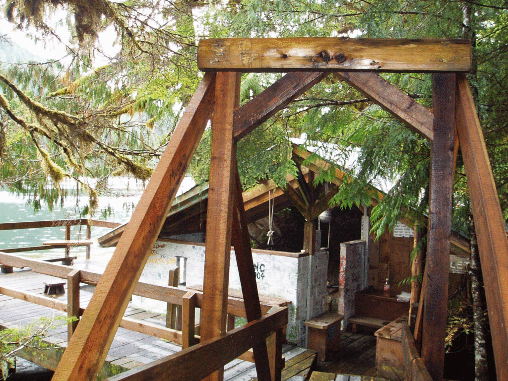
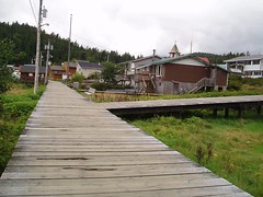
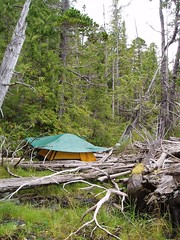
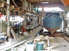
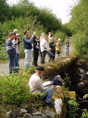
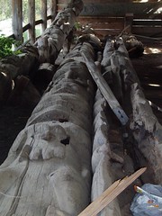
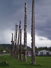
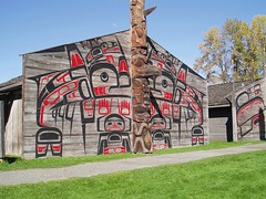
I walk around Oona River just poking my nose around old boat workshops, lumber mills and meeting the people of Oona. It was my lucky day, it was River Festival Day and there was a big celibration down at the river. Taco lunch, kids games, fish counting and a duck race. You could pick your “duck”, a float from an old fishing line that was painted bright colors, and enter it in the race. All the “Ducks” would be dumped in the river upstream and then would float down to the finish line. Almost the whole town was there, I counted 33 people. Everyone was so warm and friendly, I had a great time.

http://www.oonariver.com/

ABOUT OONA RIVER
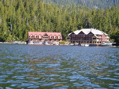
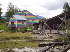
Many members of the founding families of the Oona River settlement were Scandinavian homesteaders who were recruited to live in the Northwest in the early 1900s. At its peak, the tight-knit community had more than 100 residents and 25 homes. Until the 1970s, fishing and forestry provided a stable economic base that supported the rural lifestyle preferred by its residents.

wPict3b
Originally uploaded by Au_Kalan.


Oona River's population is now about 35. In addition to "old timers", it continues to attract new residents who take pleasure in the lifestyle. A number of mainland families own residences in the community, travelling to Oona River on weekends, holidays and during the summer months. "Oona" is considered to be an especially great place for children, providing a safe, secure environment where they may experience freedom and independence and a sense of family and community.
The Setting
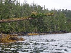
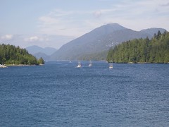
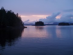
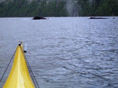
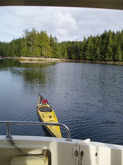
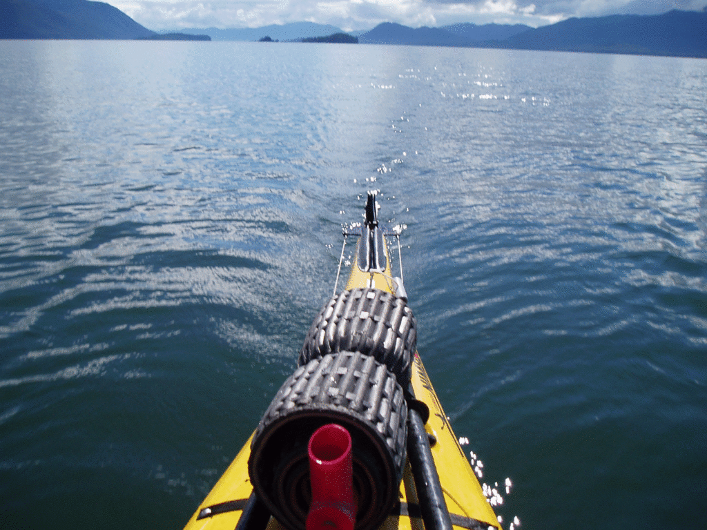
The community of Oona River is situated on the lee side of Porcher Island in a well-protected harbour at the mouth of the Oona River. It faces eastward, looking over Ogden Channel toward the Skeena River. Twice a day the view is dramatically altered with the changing of the tide. As the water drops, stone fishing weirs used by Aboriginal fishers, perhaps as many as 5000 years ago, are revealed, offering proof that the river has long supported prolific salmon runs and helped to sustain the people of the coast.
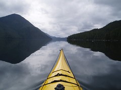
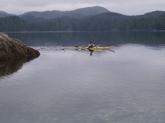
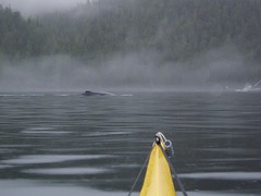
The community is set in the spectacular oceanic waterway known as the Inside Passage, plied by cruise ships and recreational sailors, alike. Sheltered coastal inlets, pristine islands, and abundant fish and wildlife draw sightseers and visitors from near and far.

September 4, 2005


Pwict4
Originally uploaded by Au_Kalan.
The Weather Gods smile upon me today.
For my last day of paddling they give me a day of sunshine and light winds.
They had played with me by serving me up 20 days of rain and wind and I guess they were happy on how I stayed the course.
I paddle across Malacca Passage across lightly rippled blue water and bright sunshine, I have not seen sun like this in 3 weeks.
The trip ends at the Prince Rupert Rowing & Yacht Club at 6:47 pm


PSS – Would I do the trip again? YES, this was a one in a lifetime trip that will give me wonderful memories till my last days.
- Did I learn anything? Yes and No. I am no closer to solving the problems of the world at the mysteries of Universe. But I did learn new things about myself, and countless nuances of the ocean.

Tuesday, September 20, 2005

Totem Poles of the Skeena River


t9
Originally uploaded by Au_Kalan.
Here are some Totem Poles from our drive back from Prince Rupert, BC.


Monday, September 19, 2005

End of Trip

End of the Trip
It is September 12, 2005 and I am back in Seattle.
It feels strange to be back, hardly anything has changed and I feel like I have been gone so long.
Hope you have enjoyed my stories
Till my next adventure

TTFN
.