I have made it to Alert Bay!!!! I'm spending the day stocking up and getting ready to head out tomorrow - July 31st.
Time is short, so is this entry
I want to thank all the wonderful and friendly people of Sayward who helped me on my travels
Kayakers - Stay out of Telegraph Cove, it was a nightmare for me
As bad as Telegraph Cove is, Alert Bay is wonderful (That ying-yang thing)
Totem Poles, Long Houses, Museums, Carvers, friendly people.
A full rendition of my travels will be entered at a later date
My next entry should be in about two weeks from Bella Bella
Saturday, July 30, 2005
Wednesday, July 27, 2005
July 25 - CROSSING JOHNSTONE STRAIGHT
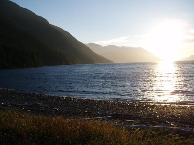
Leave my little Island early in hope of missing some of the wind, just more hopefully thinking. I cross Johnstone Straight in 15 knot winds and 2 to 3' waves. It was an epic battle but I make it across and then paddled up the coast of Vancouver Island to Camp Point where, you got it , I camped.
July 26 - 27, Sayward
On Tuesday morning I paddle the final 5 miles into Sayward where I am spending two days. The plan was to rest and stock up on supplies and head out on the morning of the 28th.
TRAPPED BY THE WIND
The wind has been picking up for the last two days, it had been holding at 15 to 25 mph which is Small Craft Advisory(15 mph) and Warning(25 mph). But tonight and tomorrow it is now GAIL FORCE (35 mph). I don't go out in that. Time to wait for the wind to change.
Sayward
Is filled with wonderful people, from Cindy who runs the Burger Shack at the marina (I lost count of how many burgers I ate, they were that good) to "Sayward Jacquie" at the Sayward Futures Society on the warf. Jacquie, I hope you start your Blog and have fun with it.
This will be the last update till Alert Bay.
July 22 - OKISOLLO RAPIDS
Today I had to wait till 6:35 pm for the tides to turn to slack in the Upper and Lower Okisollo Rapids. Spent the day cleaning gear, stuff and myself, reading and relaxing. As always the wind is blowing and I slowly, inch by inch crawl up the shore. Since I had to start at such a late time today I pushed on till 10:15 pm to a camp behind Howe Island that I knew about.
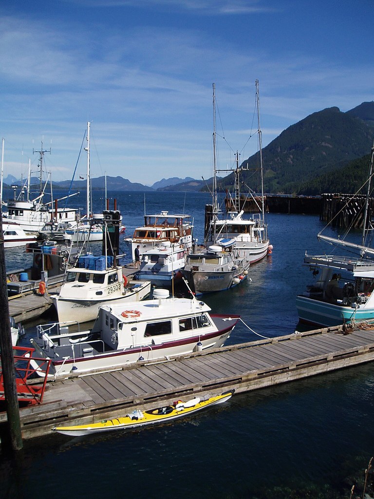
July 23 - Blind Channel Resort
More Wind from the NW, I crossed Nodales Channel and travel up the west side of Thurlow Is. At Edith Point I get turned back by strong winds and a wild tidal rip. I hide in a bay about half a km back for 1 1/2 hours. I then sneak around Edith Point and finally get to paddle with the wind and current at my back. I travel 4 miles in 45 minutes to Blind Channel Resort. WOW, it took me 4 1/2 hours to go 5 miles to Edith Point and only 45 minutes to get over the next 4 miles. At the resort I am able to call Mary Lou, have a soda. I relax on the patio and end up talking to Glen, a retired fisherman who has sold his boat and license. The people at the resort had asked him to move to the resort and help out. He has a nice little house to live in and takes care of the place during the winter a basically has every summer off. Kayak across the bay to a little island smaller than my yard in Ballard.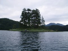
July 24 - Rest day
Spend Sunday as a day of rest. Paddle over to the resort and have breakfast at the bakery.
Belted Kingfisher - I did not see him till he flew of the trees 30' from me. The Kingfisher flew straight at me and dove into the water only 10' away. A few seconds later it popped back to the surface and flew back to it's tree with a 3" fish. The first thing that he did once he got to the branch was to shake his head and pop up his crest feathers on top of his head. He look damned proud of himself.
Tuesday, July 26, 2005
July 21 - SURGE NARROWS

Plan a long day, I'm up and in the water by 6 am. I paddle out of Teakerne arm and turn up into the wind in Lewis Passage. I fight the wind as I go up the narrow passage that is funneling the wind, once I get the the far side the wide lets up some. I cross the next open water and then paddle south through White Rock Pass to the beginning of Surge Narrows.
As I am passing along the shore I see a little brown Pine Martin running along the shore, down to the water and then he dives in the water. He pops back up with a little fish in his mouth. THEN a bald eagle flies over my left shoulder and lands on a rock just above the martin who dives under the rock to hide. The eagle then notices me 20 feet away and decided that I'm a little to close, make me feel good to save the little guy.
I will not be able to pass the Surge till slack tide, which is in 5 hours. I pull over and sit on the beach, have lunch and grab a book to read. While I am sitting there another kayaker shows up, Roger, a local who gets around to the store an friends by his kayak. He gives me great info on how to do the Surge and that the local store is open. Local info is always the best.
Watching the sealife under my boat and amazing thing happens in just a few miles. There is hardly any seaweed in Desolation Sound, but by the time I reach Surge Narrows I have rainbow of seaweeds under my boat, Kelp, Sea lettuce, Turkish Towel, etc. There are thousands of clams squirting in the sand flats.
I paddle over to the Surge General Store and spend the rest of the day with the owner Teresa till slack tide. I pass through the Surge with no problem and end up on Octopus Islands for the night. As I fall asleep that night I hear my first Loon of the trip.
July 19, The first paddle strokes of the trip
I take my first paddle strokes north, this is the start of my 2-month adventure. It is hard to believe that I will by kayaking for two months up the Inside Passage of BC.
( http://www.nwboat.com/refuge/ )
OKEOVER INLET - start from the government dock and say my goodbyes to Mary Lou, and paddle NW under cloudy skies and wind from the NW. The weather clears to sun and light breezes as I exit the Okeover Inlet and cross Desolation Sound to my first camp on a saddle between the two Martin Island. Unpack the boat, what was I thinking, I have way to much stuff, books, cooking stove and pots, food, carving tools, camping supplies. I need to organize and repack stuff, well I got two months to figure that out. Go for a swim, Desolation Sound has warm water, what a treat.
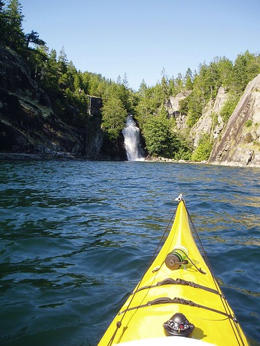
July 20, Teakerne Waterfalls
Wind has blown all night. Paddle over to Refuge Cove to give Mary Lou her first of many phone calls from the trip.
From there I kayak over to Teakerne Waterfall Prov. Park, dock I hike up a short trail to the lake where I go swimming for an hour in crystal clear warm water, this may be my only warm water swim of this trip. Camp about 1/2 km away on a small rock outcrops and watch the sunset over the water.
On the way in today I paddled around a corner of rock and found myself 10 feet away from a seal and her pup. They just watched me go by with there big black eyes. I don't think I scared them to much, they were still sitting on the rocks when I looked back from 30 m away.
July 16, Saturday - Going Away Party
Mary Lou had set up a great Going Away Party. I had a great time, Thank you everyone for taking the time to see me off. In some ways it amkes it harder to leave when you see so many of your friends.
The nest day we drove up to Canada and stopped in the night in Sechelt, BC. We found a wonderful little B&B by accident, the C-Breeze Waterfront B&B. It is on a hill overlooking the water and they have an increadible garden, giant gunnera, willows, flowers, and a private two person hot tub. (www.cbreezes-bb.com) Nice little cozy rooms overlooking the garden and water.
The nest day we drove up to Canada and stopped in the night in Sechelt, BC. We found a wonderful little B&B by accident, the C-Breeze Waterfront B&B. It is on a hill overlooking the water and they have an increadible garden, giant gunnera, willows, flowers, and a private two person hot tub. (www.cbreezes-bb.com) Nice little cozy rooms overlooking the garden and water.
Sunday, July 24, 2005
Au Kalan is the Kayak's name
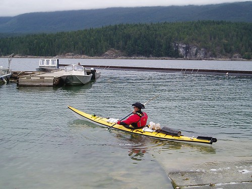
Yes, for those who asked, Au Kalan is the name of the Kayak. Now you ask what does it mean? Well, many of you know I used to be a Chemist in my previous life before becomming a firefighter, from the world of chemistry Au = Gold. Well, as many of you don't know, a majority of my bloodline is Russian, Kalan = Otter. This makes my bright yellow kayak the Golden Otter.
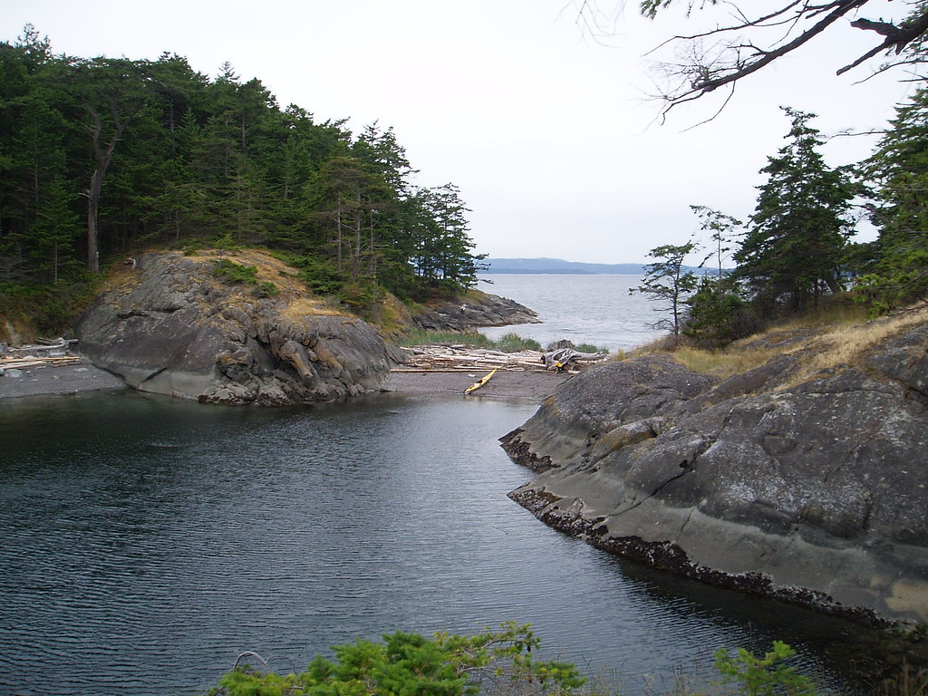
Trapped by the WIND
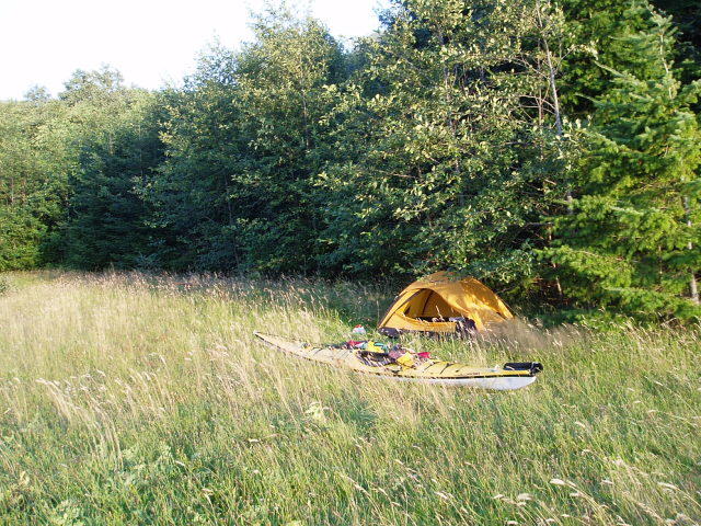
It's Sunday, July 24th and I am trapped near Blind Bay Resort on East Thurlow Island, BC. I have been battling 15 to 25 knot winds from the NW for the last 3 days and I am ready for a rest day. I am now camped on a small island about the size of my yard in Ballard, no bears to worry about, but I do share the island with a currious Pine Martin (cute ferrit). I hope to push NW up Johnstone Straight tommorrow.
Friday, July 15, 2005
Kayak route map of Inside Passage
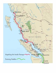
This is the proposed route that I will take this summer. My revised plans have me starting at Lund, BC around July 19, 2005. I have changed my original plans due to, well, limited time for the trip and the many unknowns(How fast can I paddle, will the weather GODS be nice to me?). Because of this I will skip the Central Coast from Sidney, BC to Lund, BC. This has been a hard choice to make, but at this time I think it is a good one.
You can click on the map to the right to enlarge it.
Contacting me via. Canadian Post
As I am traviling North I will be stopping at several towns where I will be picking up my Kayaking Care Packages (more books and good food, spices). If any of you-all would like to send a letter to a lone kayaker to liven up his day, here are the addresses: (You need about two weeks for delivery)
I should be in Alert Bay July 27th
Chris Pope Attn: Barb
General Delivery
Alert Bay, BC
V0N 1A0
Canada
“Please hold for pickup by Kayaker Chris Pope July 22 to August 4, 2005”
I should be in Bella Bella August 12th
Chris Pope
General Delivery
Bella Bella, BC
V0T 1B0
Canada
“Please hold for pickup by Kayaker Chris Pope August 6 - 20, 2005”
I should be in Hartley Bay August 29th
Chris Pope
General Delivery
Hartley Bay, BC
V0V 1A0
Canada
“Please hold for pickup by Kayaker Chris Pope August 20 to September 10, 2005"
Kayaking the San Juan Islands
CROSSING THE SAN JUAN ISLANDS
Anacortes, WA to Sidney, BC. Canada
June14 to 17, 2005
June 14th, Anacortes to Orcas Island. Worked again last night, twas another busy 24 hours. I drove up to Mt. Vernon after work and had breakfast at the bakery. The bakery has a book store attached to it and it was open this time. One of my weaknesses is books, I ended up with 4 new ones; Darwin – Origin of Species, Dante’s – Inferno, Purgatorio and Paradiso. Maybe I will have time on the trip to read them.
I launched from the Anacortes State Park, cross the Bellingham Channel to Reef Point on Cypress Island and then over to Strawberry Island where I had lunch. There are nesting Orange billed Oyster Catchers on the island. If you sit still they ignore you and stay quiet, but if they see you moving they set off in a horrible blast of BEEEE, BEEEE, BEEEEES. From there I crossed Rosario Straight to Blakely Island. There I was about twenty seals lazing on rock in the sunshine. Some of them would roll off the rocks as soon as they saw you, others would look at you and not move, as to say – I’m comfortable, go away. Spend the night at Obstruction Pass Park on Orcas Island.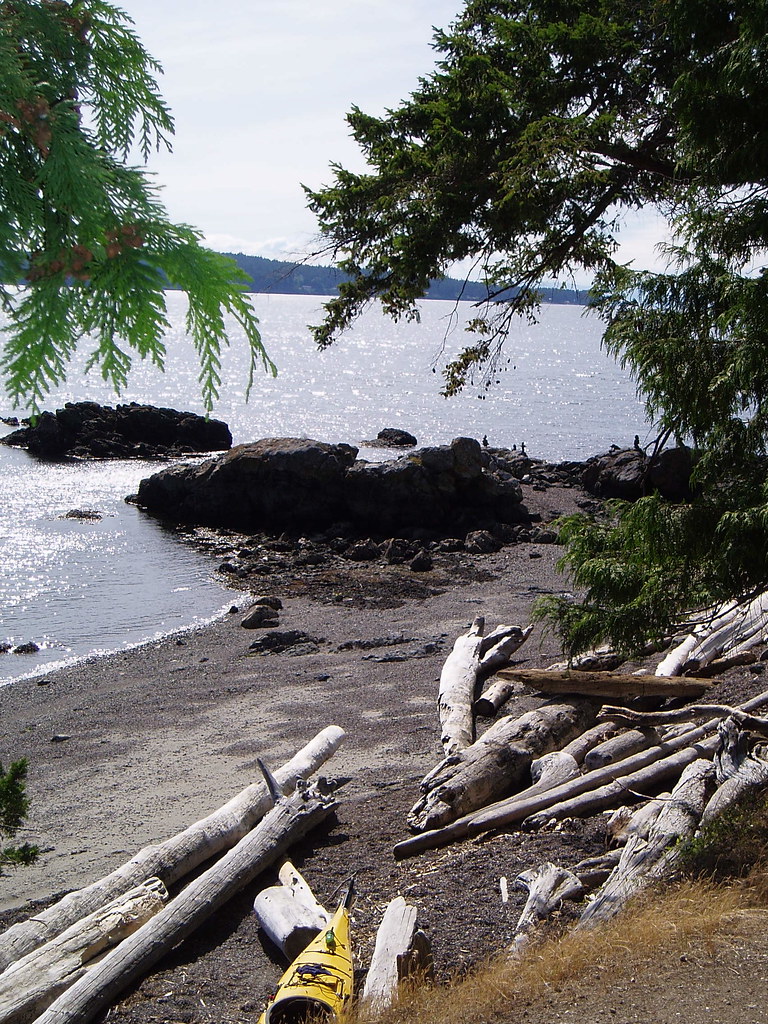
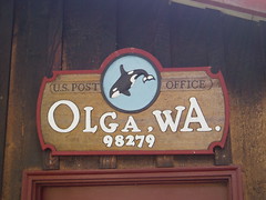
June 15th, Orcas Island to Jones Island. Paddle over to Olga, Orcas Island for breakfast at the Olga Gallery and Café. This is an incredible store, all the art is from artist who live on the San Juan Islands. They have high quality, hand made paintings, pottery, books, glass, scarves and the list goes on. I picked up a gift for Mary Lou and headed back out. Kayaked west over Hartley Channel to Blind Island for lunch and then off to Jones Island to set up camp for the night.
Picture above is a sunset on the beach at the Jones Island camp site.
Anacortes, WA to Sidney, BC. Canada
June14 to 17, 2005
June 14th, Anacortes to Orcas Island. Worked again last night, twas another busy 24 hours. I drove up to Mt. Vernon after work and had breakfast at the bakery. The bakery has a book store attached to it and it was open this time. One of my weaknesses is books, I ended up with 4 new ones; Darwin – Origin of Species, Dante’s – Inferno, Purgatorio and Paradiso. Maybe I will have time on the trip to read them.
I launched from the Anacortes State Park, cross the Bellingham Channel to Reef Point on Cypress Island and then over to Strawberry Island where I had lunch. There are nesting Orange billed Oyster Catchers on the island. If you sit still they ignore you and stay quiet, but if they see you moving they set off in a horrible blast of BEEEE, BEEEE, BEEEEES. From there I crossed Rosario Straight to Blakely Island. There I was about twenty seals lazing on rock in the sunshine. Some of them would roll off the rocks as soon as they saw you, others would look at you and not move, as to say – I’m comfortable, go away. Spend the night at Obstruction Pass Park on Orcas Island.
June 15th, Orcas Island to Jones Island. Paddle over to Olga, Orcas Island for breakfast at the Olga Gallery and Café. This is an incredible store, all the art is from artist who live on the San Juan Islands. They have high quality, hand made paintings, pottery, books, glass, scarves and the list goes on. I picked up a gift for Mary Lou and headed back out. Kayaked west over Hartley Channel to Blind Island for lunch and then off to Jones Island to set up camp for the night.
Picture above is a sunset on the beach at the Jones Island camp site.
KAYAKING INTO CANADA
CROSSING INTO CANADA
June 16th, Jones Island to Sidney, BC Canada.
6am, an early start from Jones Island because I had a long way to go that day, all the way to Canada. As I crossed Spieden Channel I encountered my first rip tides of the day, a short section of chop waves just where they are marked on the charts. The wind picked up as I approached Spieden Island so I had to paddle within 20 feet of the shore for protection. Spieden Island is private property that was set up 50 years ago as an African wildlife preserve. As I paddled along the edge of it I had the luck of seeing two Gazelles on the open meadows and two other African horned creatures sitting under some trees. I took a rest stop on Stuart Island where I found fresh river otter tracks on the beach.
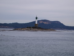
HARO STRAIGHT is the crossing into Canada. It takes me two hours with the wind an currents to make it to the lighthouse on Rum Island, the most eastern point that is close to the American San Juans. This lighthouse has been the focus of this trip, as I pass it I know I have entered Canada. I took a break on Rum Island then paddled into Sidney BC where I caught the 4pm ferry back to Anacortes.
Saturday, July 02, 2005
Mt. Forbidden Climbing Accident
Last Summer while climbing Mt. Forbidden in the North Cascades one of my climbing partners fell an broke both his legs. Here is the link to the story he wrote:
http://www.seattleweekly.com/features/0505/050202_news_mountain.php
He is still recovering from the fall but is able to walk and ride his bike now for short distances.
http://www.seattleweekly.com/features/0505/050202_news_mountain.php
He is still recovering from the fall but is able to walk and ride his bike now for short distances.
Subscribe to:
Posts (Atom)